Poetry
Polymathy
Platings
Merch
About
Contact

Clattering East

Poetry & Polymathy from the Baby Boom's Rear Flank
Poetry
Polymathy
Platings
Merch
About
Contact

Natural Bridge in Capital Reef National Park

Of Pigs, Peaks, and Pizza: Utah’s Life Elevated

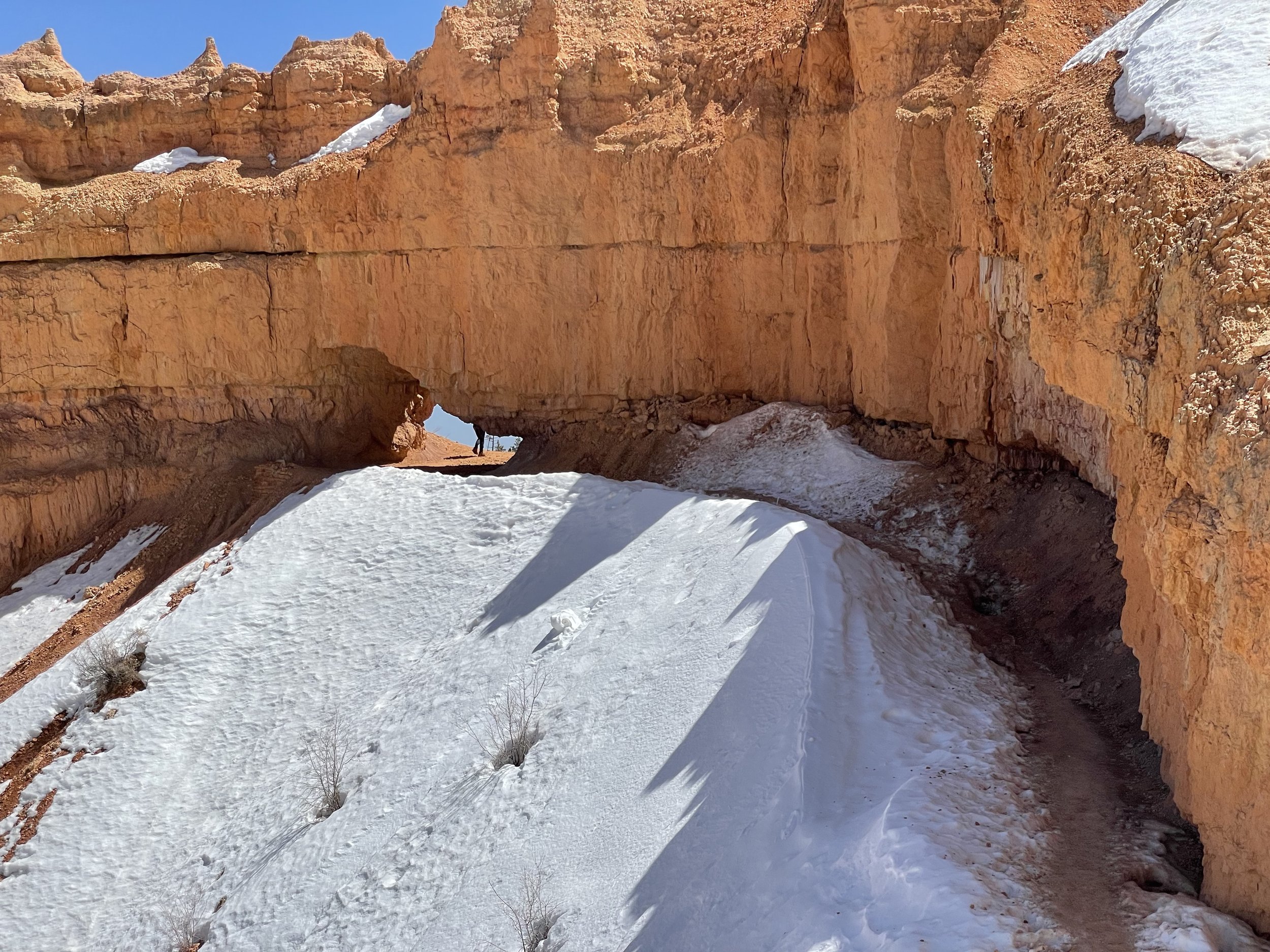
After we left Death Valley, we turned North again toward the Utah and Zion, Bryce Canyon, and Capitol Reef National Parks. At between 5,000-8,000 feet (1,600-2,600 meters) above sea level, this meant returning to winter. Bryce Canyon was particularly cold. Our first night camping just outside the park, we awoke to snow on the van again. That was the last of the snowfall, but it got even colder over the next few days.

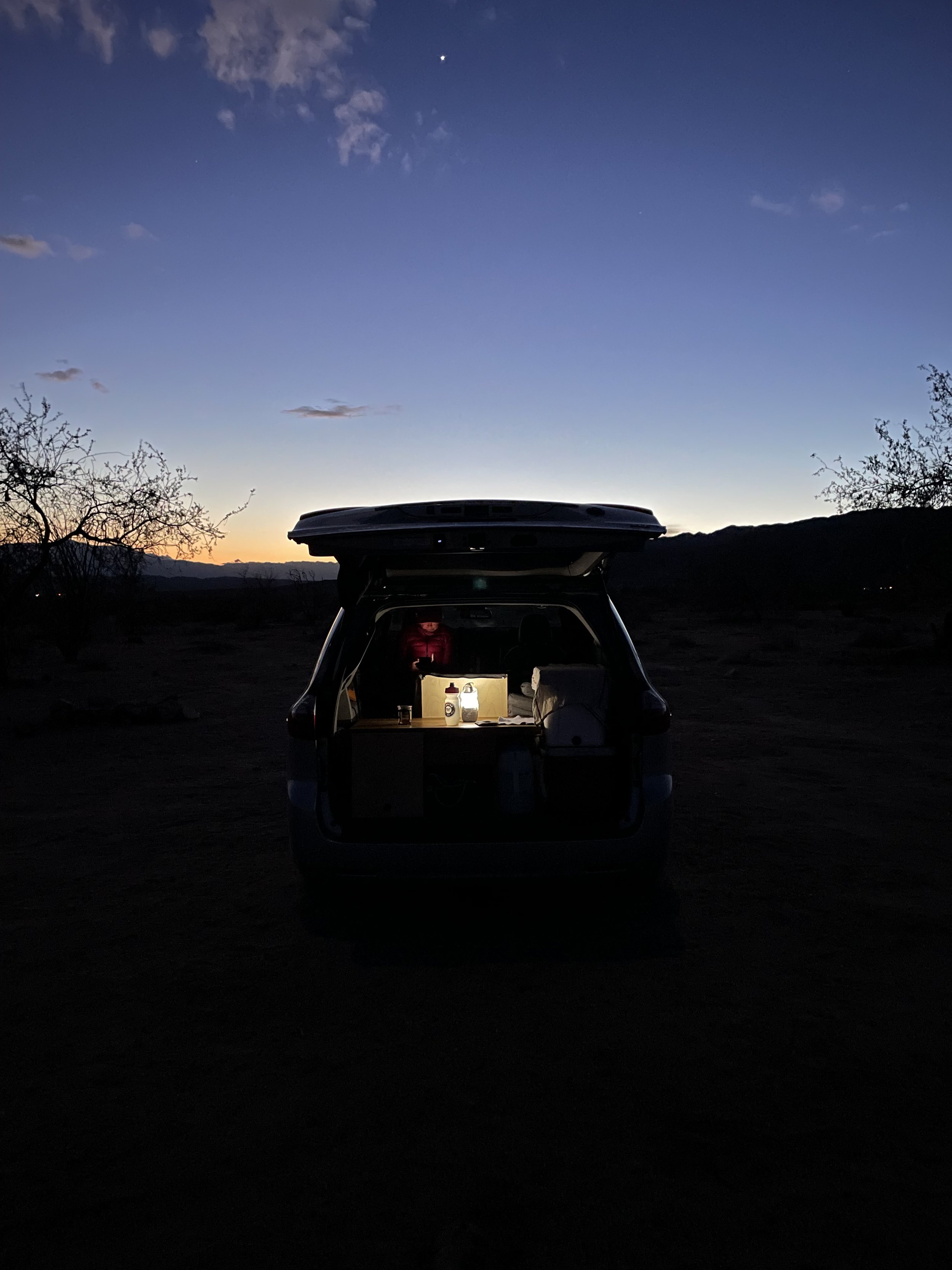
One night was well below freezing and the water in our jug froze solid and the solution in my contact lens case turned into a gel. I have never seen that happen before. Prudently, I had left several pots of water stilling out overnight. In the morning we had solid ice for the cooler, saving us having to buy ice for several days.

Still the days were clear and the sun warmed things up nicely and we were hiking in light shirts while trudging through the packed snow.

The trails in Bryce Canyon at 8,000 feet above sea level still have plenty of snow.

These three parks are absolute gems and though normally packed visitors, they were relatively empty thanks to the fact that we are still early in the season and because it has been so cold.

We celebrated the end of Passover by having lunch at a buffet outside Bryce. The first salad crouton after Passover is not as delectable as that first cup of coffee after Yom Kippur but it was a delight, nonetheless. Oh, and washed down with a crisp IPA. That’s what I’m talking about.

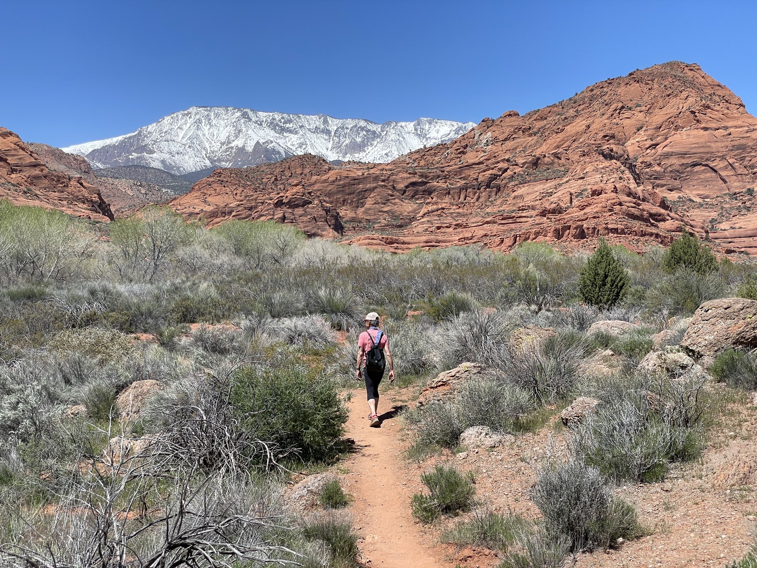
The thing to do in Zion is to hike the Angel Landing trail which leads to a spot so lofty that it was so named because it was thought only angels could get there by flying up and landing on the spot. Nowadays, anyone who is reasonably fit can just hike right up, no flying necessary, assuming you have a permit.

The hike is so popular that you must put your name into a Park Service lottery. We put in our names but didn’t get picked. You can still hike most of the way up the trail, it is just the last kilometer or so that you need the permit. We hiked up as far as we could without the permit and then turned in another direction until we were a hundred meters higher than the landing. Just to prove that we could. This was one of the most popular hikes we did in any of the parks. We were never out of sight of other humans.

At a popular rest area where people stop and eat snacks, the squirrels and chipmunks were bold as rats and would take your granola bar right out of your hand if you weren’t diligent. It was pretty much impossible to make sure that they didn’t get any crumbs even though people food is not good for them, as the park service signs reminded us.

A very cheeky chickadee.

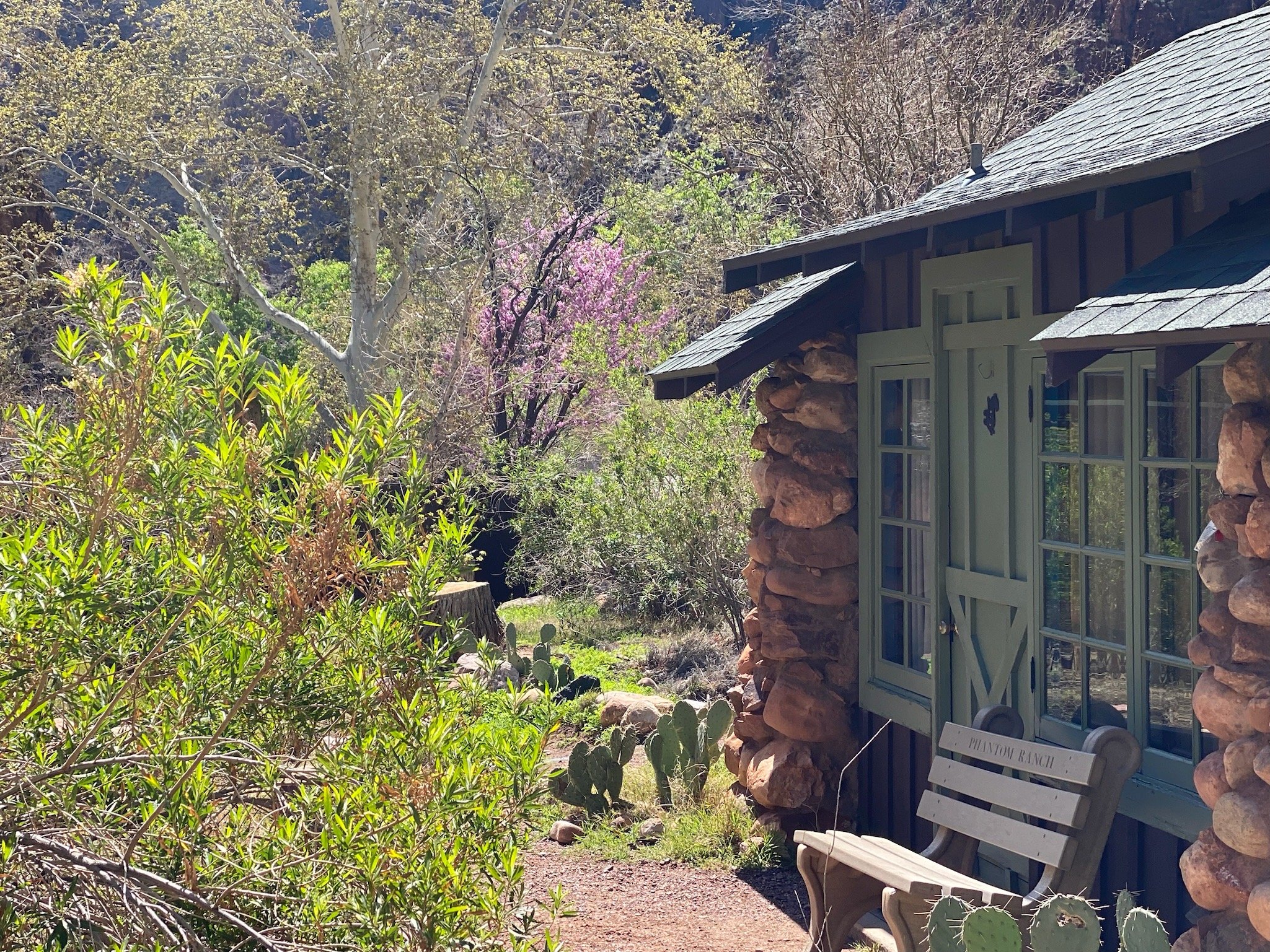
At Zion we were lucky to secure a camping spot inside the park. However, the site was a walk-up tent site, meaning that you had to park about 150 meters away from the site where you are meant to set up your tent. Normally, of course, we sleep in our van, and no one would have been the wiser if we had. But the spot was so pleasant and the evening so mild that we decided for old times’ sake to sleep in our the MSR Elixir™ 3 Backpacking Tent we always have with us for the two nights we were there.

It turned out to be a great decision. We had a gorgeous view of the stars through the mesh ceiling and though it was a bit windy on the first night, it never got too, too cold. The tent also has a larger sleeping area than the van. It was nice to have a bit more room for a change.

Capitol Reef is one of the least visited of the national parks. Maybe because of the weird name. It is not a capitol nor a reef. There are, however, staggeringly beautiful geological formations, interesting Mormon pioneer history, petroglyphs left by the native Fremont people more than 700 years ago, wild mule deer, and abandoned uranium mines (signs warn against spending more than an hour or two in the vicinity.) It was well worth a visit. The trails were uncrowded and car traffic in the park was light and so far I do not appear to be radioactive.

At a lower elevation than Bryce, the days in Capitol Reef were downright hot though the nights were still chilly, and the sky filled with stars.

Following the drinking gourd, today we drove to Salt Lake City, where tomorrow we will meet a former Hillel colleague for lunch.

After we arrived and got settled into the KOA, we took the light rail from the campground into downtown Salt Lake ($2.50). When we departed camp, it was warm and sunny and we left our down coats and hats behind. By the time we reached downtown, however, the weather had turned cold and windy. Just as I was wishing I had brought my coat and hat, it started to hail. We ducked into the City Creek mall and had a slice of authentic Utah pizza (Sbarro) while waiting for it to blow over. It didn’t.

We allowed ourselves to be blown about downtown for a while gawking at the Mormon stuff and some of the cool historic buildings, but we were underdressed for the weather. We grabbed a pound of coffee at a local establishment (running low) and jumped back on the rail back to camp (Free. Our tickets hadn’t yet expired.)

Anyone who thinks that the earth is overcrowded with people, hasn’t been to Utah. Today we drove hundreds of kilometers without seeing much in the way of towns, houses, or people. Just beautiful countryside, snow capped mountains, and rolling hills of forest, scrub brush, and the odd cow.

On the highway, we passed a truck that screamed livestock. The sides of the trailer were a mesh of holes. As we passed, I realized that it was made up of about one hundred individual crates (10 long by 3 wide by 3 high). Each tiny crate contained a single pink pig. Sweet looking creatures really. Through the vent holes I could see their floppy ears or their eyes as they peered out. They looked cold. Though I am not a vegetarian, it gave me pause to think of where those pigs were headed. Likely, in a very short time, they will all be hams and packages of bacon. I don’t eat pigs, of course, but the chickens and the occasional cow, I do eat from time to time certainly fare no better.

After Salt Lake we ascend to Logan, Utah where my cousin (once removed) is having a show and reception for her master’s thesis in ceramics. This will involve two luxurious nights in a hotel. Then we will mash potato through Idaho, which Barbara will check off as her 49th visited state and finally turn the grimy silver bonnet of the van toward the rising sun and home albeit still many thousands of kilometers away.

PostedApril 20, 2023
AuthorDennis Kirschbaum
2 CommentsPost a comment

Rocks and dunes of Death Valley National Park

Desert Wanderings

After leaving the Grand Canyon, our original plan had been to head towards the National Parks in Utah, but a glance at the weather in those locations suggested another plan might be advisable. Both parks were below freezing and still experiencing snowstorms when we left the canyon rim. So instead, we turned south toward the Mojave National Preserve and Joshua Tree National Park which promised warmer climes.

The Mojave Preserve is a beautiful kind of dessert filled with Cholla Cactus and unusual rock formations. It was nice and warm during the day but still chilly at night. We went for a short hike and saw a herd of wild horses (Well, five. Is five a herd?). We camped at a place called Hole in the Wall, which would have been perfect but for the RV generators that now accompany any camping experience in a campground that doesn’t explicitly prohibit them or offer electric hookups. Sometimes the owners follow the rules and turn them off after 8 pm but they start them right up again in the early morning. We were forced to drive off in search of a quiet place to make and drink our coffee.

As beautiful as Mojave is, it is fairly uniform in appearance throughout the preserve except for the area of the park that has incredible sand dunes. Joshua Tree on the other hand is packed with diverse landscapes and botanicals but is desert-like as well.  We spent several days there hiking around and camping for free on Bureau of Land Management (BLM) land. There were a large number of people camping out but it was fairly easy to find an area pretty far from other campers. Though we could hear the generators, they were not as intrusive as when they are right next door. Also, free camping so one can’t complain too much.

Nightfall on BLM land.

The downside of BLM Camping? No water taps, no toilets, no picnic tables to cook on. It’s as rustic as you can get without strapping on a backpack.

The Utah parks now seem to be thawing so we figured it is time to give them a try. On the way back to Utah we stopped at another desert park, Death Valley National Park. It took us the better part of two days getting there almost getting caught in the gravitational pull of Los Angeles and definitely getting caught in LA traffic.

Near Riverside, California we found a Trader Joe’s that had kosher wine and nearly everything we needed to make a seder and survive Passover on the road. Except matzah. They had none. There was another grocery store in the same shopping center that had plenty of matzah but just a single box that was kosher for Passover. Luckily, I had brought 3 boxes from home so with some careful rationing, we should be fine.

A camping innovation, the open face Hillel Sandwich.

We made our Passover Seder for two in a quirky KOA near Lake Isabella, Calif. with some odd substitutions. For bitter herbs, we had radishes. For a shank bone we had a stick. The choroseth, however, was delicious made with a juicy apple, roasted almonds some cinnamon and sugar. Our seder meal was chickpeas with Indian spices (we are Sephardic when it comes to Passover).

Next we explored Death Valley National Park, spending the several days there. The daytime temperatures well into the high-20s (80s F) and even in early April the sun is relentless. It felt hotter than the actual temperature. The freezing temperatures and snow of the Grand Canyon were a distant memory. We did a few hikes in the heat and checked out the Badwater Basin, the lowest point in the continental US and home of “the world’s toughest foot race.” 135 miles? I could barely make it half a mile from the car and back in the heat.

Signs and wonders.

This is the first-time I have had the chance to spend Passover literally wandering around in the desert and it feels wholly appropriate. Many cultures have viewed the desert through a mystical lens. It is a land of temperatures extremes, unforgiving winds, and strange creatures that can tolerate these conditions. It is easy to see why the desert has been associated with both liberation and revelation. The desert forces you to focus on life’s most basic needs: shelter from the sun, wind and cold, protection from the elements with the right clothing, and water.  At the same time it invites reflection on the intangibles.

Speaking of water, also heightening our desert experience has been our limited access to drinking water! The KOA at Lake Isabelle warned us not to drink the water at all due to nitrate pollution from agricultural run-off. At the Death Valley Campground they advised boiling the water before drinking due to possible biological contamination.  Fortunately, we carry 5 gallons of drinking water with us, but have to use it sparingly to make sure we don’t run out of drinking water before we reach a tap that has potable H2O. Being sparing with the drinking water is not ideal in the desert. Fortunately, there are soda machines at all the visitors centers and gas stations!

The last stop in our desert wanderings is Hurricane, Utah: a jumping off point for some of the national parks that grace southern Utah. We were running low on kosher wine (though plenty of water at this point) so hoping against hope, we stopped at a state controlled liquor store (this IS Utah after all) and they had enough kosher wine to last just one day. But we are hoping that with a miracle, the wine will last the remaining days of the holiday. Wait, wrong holiday.

No matzah at the Hurricane Walmart though. Not a scrap to be had — kosher for Pesach or otherwise. Just a box and a half left in the food box.

As Passover winds down we will begin ascend to higher elevations where cool temperatures and maybe more snow await.

Our destination? Appropriately enough: Zion.

Not the holy land, the National Park.

Next year in the Negev!

Among the red rocks of Hurricane, Utah. Cooler climes ahead.

PostedApril 10, 2023
AuthorDennis Kirschbaum
2 CommentsPost a comment

Warning Signs!

Grand

“Caution! Down is Optional. Up is Mandatory” read the sign at the trailhead.

Once you hike into the canyon there are only two ways out. The first is under your own power. The second is by helicopter, which is a reservation only available to those who die down there. We did not aspire to be part of that select company.

The morning that we were to hike down to the bottom of the Grand Canyon, we pushed open the door of the van to reveal that a fresh layer of snow had fallen overnight. In fact, it was still snowing. A wicked wind was blowing through the campground forcing us to make our final preparations in the van with the doors closed virtually ensuring we would forget something important.

With packs packed and boots laced, we drove over the icy roads to the Backcountry Information Center where the Hiker Express bus runs on the hour to the South Kaibab trailhead. The bus was filled with hikers from far flung places like Georgia and Canada. The bus disgorged us at the trailhead, and we struggled to put our crampons over our boot soles without falling over in the snow.

That done, we snapped a few obligatory trailhead pics and started down.

Going down was not difficult. The snow had stopped, and the skies had cleared. The crampons held us firm on the ice and snow. As we descended the temperature rose increasing about 5 degrees F for each 1,000 feet of descent. After about a mile and a half, the snow was gone, and the crampons came off. We were prepared with a Garmin GPS, the Gaia App for iPhone, and a good old map and compass just in case. None of it was needed. The trail was clear and very easy to follow. Just look for (and try not to step in) the mule dung. Two mule trains passed us on their way up. The tourist mules are not running right now but the animals are still used to carry all the food and provisions for the lodge down and all the garbage back up.

Descending to the mighty (and murky) Colorado River.

It took us about 6 hours to descend to the bottom of the canyon.

The famed Phantom Ranch reachable only by foot, mule, or raft was built by the Civilian Conservation Corp in the 1930s and is a rustic beauty. We were very luck to score a cabin to ourselves. We arrived at about 2:30 pm, checked in, and confirmed our meal reservations. With lots of time before dinner, we settled in. We had a toilet and a sink in our cabin, but showers were in a separate and shared bathhouse. No matter. The showers were hot, and the water pressure was good. A real treat after our hike.

Meals are family style. Dinner was a simple affair. Salad, vegetarian chili, corn bread, and blondies for dessert. For meat eaters there was beef stew or (for an upcharge) steak. It was all-you-can eat and after our hike we could eat a lot.

We slept soundly in our heated cabin.

Cabin #6 at the famed Phantom Ranch. Photo: Barbara Raimondo

We had the next day free to explore the bottom of the canyon and relax. We checked out the campsite (where we would have been had we failed to get a cabin reservation) and did a short 10 km hike. It was a beautiful sunny day at the bottom of the canyon and plenty warm at about 20 degrees F higher than the rim.

After our hike under blue skies, I finished my book, Wild by Cheryl Strayed about a young woman who solo hikes the Pacific Crest Trail. A beautiful and moving story. I recommend.

Dinner that night was identical to the day before. They serve the exact same meal every day.

It was just as good.

During the meal we chatted with the server, a middle-aged man from Kentucky, who has been on the Ranch service staff for more than a year. Employees work 10 days and then have 4 days off. Their duties include cooking, serving meals, cleaning rooms and whatever else needs doing.

If workers choose to go up to the rim on their days off, one of the four days off is spent climbing out and another coming back down. When he chooses to leave, our companion heads off to Flagstaff, Arizona for a nice meal and a hotel with a hot tub. It seems like a solitary kind of life, juxtaposing the staggering beauty of living in the canyon with a profound separation from friends, family, and the world going on up above. I’d be curious to try it for, say, a week.

The following morning, we grabbed free coffee from the canteen and by 7 am we were on our way back to the rim by a different route, the Bright Angel Trail. Most hikers choose this route for the ascent. Though longer (10 miles vs. 8), it is, theoretically, less steep.

Don ‘t be like this guy! Be sensible, stay overnight at the Ranch!

The first few miles are, in fact, quite easy. The trail follows the river downstream and by the time you start to climb, you are actually 100 feet below the elevation of Phantom Ranch. At 3.5 miles your reach the lush and green Havasupai Gardens. Formerly known as Indian Gardens, this plateau is rich with water. A swift and clear stream runs through. The area was inhabited by native people long before Europeans arrived. Today there is a campground for backpackers, a ranger station, and a spigot for drinking water. We stopped to eat our sparse lunch of Lance Toasty Crackers and peanuts and to refill our bottles before the next part of the ascent.

After Havasupai the way grows much steeper, and the temperatures start to drop. The sun vanished and was replaced with freezing rain. The last mile and a half are the steepest and hardest. The rim seems to tower above for hours and never seems to get closer. The younger folk and the day hikers with no packs sailed past us. Soon we were once again trudging through the snow.

Compounding the effort, we could feel the air start to thin as we passed the 6,000-foot mark on our way up to the rim at 7,000 feet above sea level. Our muscles were spent and sore by the time we reached the top. There are those who say it is harder to go down than to go up. That was not the experience of this hiker.  Gravity may be an illusion, but it is a terribly convincing one.

Once back at the rim a cold wind blew through our sweat drenched clothes, making it feel much colder than freezing. We had camping reservations for the night, but I suggested a hotel room with a warm bed and a hot shower assuming there was an opening at the Bright Angel Lodge just steps away. It didn’t take a lot of convincing for Barbara to come around to my point of view on the matter.

There was a cabin available, and we grabbed it, dining at the Pizza Pub in one of the lodges that evening. The pizza was nowhere near as good as mine but tasted mighty fine notwithstanding.

The following day we had reservations at the fancy El Tovar dining room where waiters in white shirts, black pants and bow ties serve up a bistro style fair. I had a bowl of butternut squash soup, a vegetarian quiche made with brie cheese and a side salad. We split a dessert of pear cheesecake served with a blackberry reduction. Staggeringly good.

We had planned to head from here to Bryce and Zion National Parks but a glance at the weather app would recommend otherwise. More cold, more snow. The Mohave National Preserve and Joshua Tree National Park look a bit more temperate at this time of year.

Five million people visit the canyon each year and climbing down even part way, is something they say fewer than one percent of visitors do. Yes, it was cold and hiking up was hard, but it was a once in a lifetime experience and I wouldn’t have changed a thing.

Years from now when asked how it was to hike to the bottom of the canyon, I’ll reply:

“Grand. Just Grand.”

Our route according to the Gaia app. Brown is down. Red is up.

PostedMarch 28, 2023
AuthorDennis Kirschbaum
5 CommentsPost a comment
Newer / Older

© Dennis M. Kirschbaum. All rights reserved worldwide. Full notice.